Study highlights growing importance of multi-day storms in future U.S. flood risk
Wednesday, May 13, 2026
Media Contact: Desa James | Communications Coordinator | 405-744-2669 | desa.james@okstate.edu

Research conducted at Oak Ridge National Laboratory by Dr. Gabriel Perez, in collaboration with researchers involved in the U.S. Department of Energy’s Southeast Texas Urban Integrated Field Laboratory (SETx-UIFL) initiative, found that while extreme rainfall is projected to intensify across the United States, some of the largest increases may come from storms that last several days rather than from short, intense downpours.
The Southeast Texas Urban Integrated Field Laboratory is part of the U.S. Department of Energy’s Urban Integrated Field Laboratories program, which seeks to improve understanding of climate and environmental processes affecting vulnerable urban regions, including flood-prone communities along the Gulf Coast.
Perez, now an assistant professor for the School of Civil and Environmental Engineering at Oklahoma State University, suggests that prolonged rainfall events could play a growing role in future flood risk, particularly in regions influenced by tropical systems.
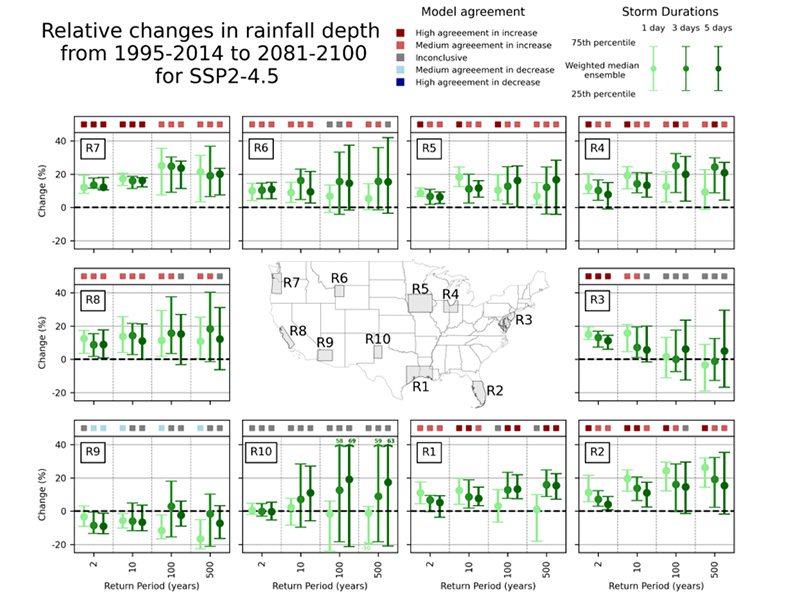
The study, published in Environmental Research: Climate, analyzed projections from 34 downscaled climate models to evaluate how extreme rainfall may change across 10 regions of the contiguous U.S. under different future emissions scenarios.
“Extreme rainfall is projected to become stronger overall, but it’s not just about how hard it rains,” Perez said. “In some regions, storms that last several days may intensify even more than short-duration events, which can have very different and often more severe flooding impacts because rainfall accumulates over time.”
The research examined both daily and multi-day rainfall extremes across a range of return periods, including rare events such as 100-year and 500-year storms. By using a large ensemble of climate models, the team was able to identify consistent trends while reducing the uncertainty associated with relying on a single model.
“No single climate model captures every aspect of the climate system,” Perez said. “By looking across many models together, we can better identify which projected changes are robust and where uncertainty remains.”
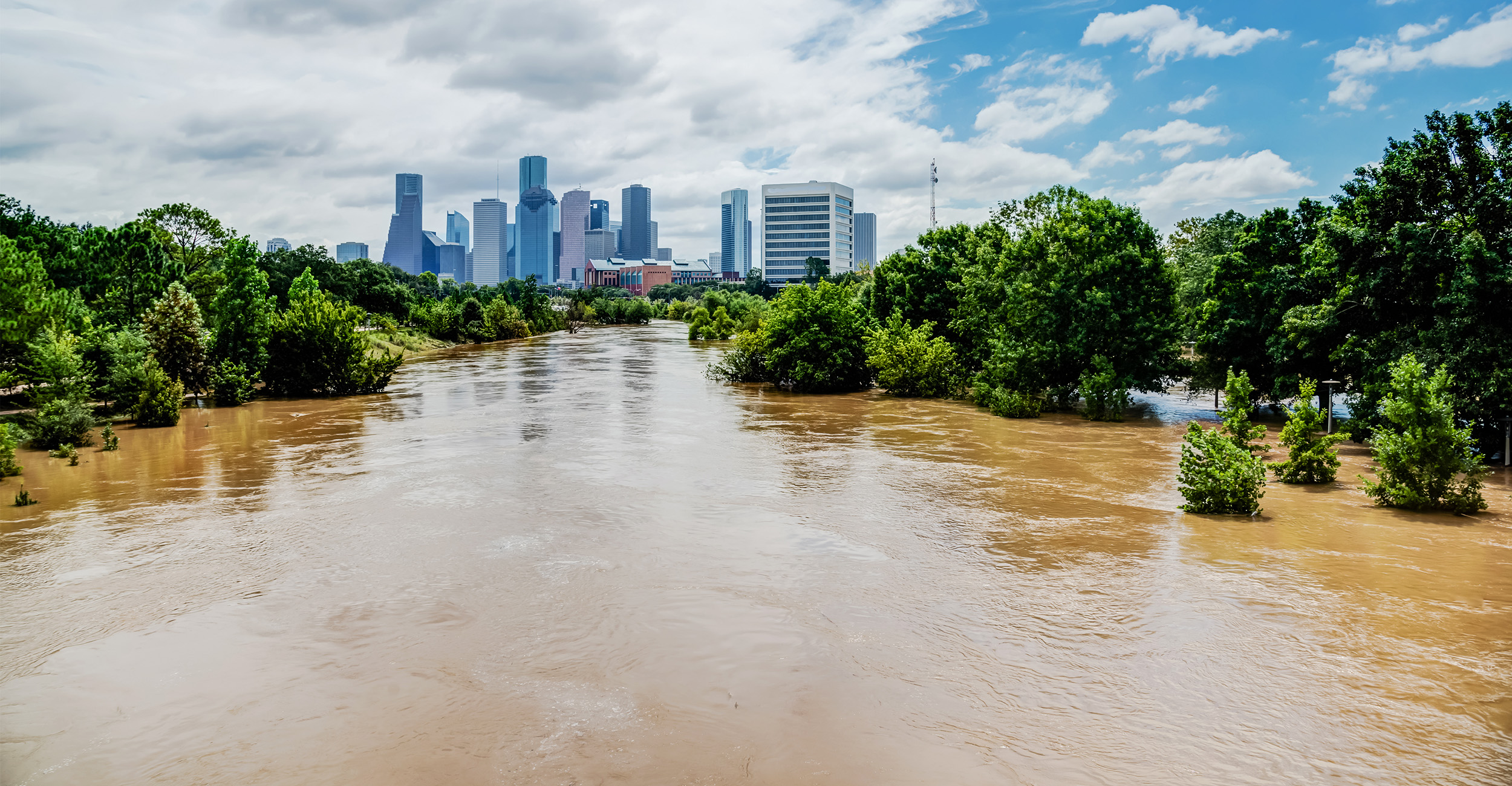
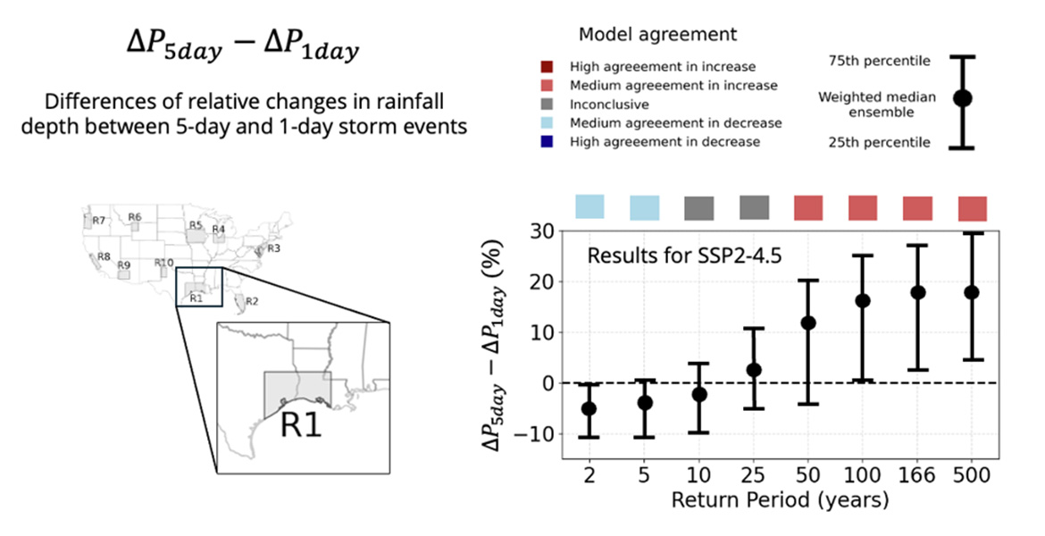
One of the study’s most notable findings emerged along the western Gulf Coast, where very rare multi-day rainfall events were projected to intensify more than their single-day counterparts. The region is strongly influenced by tropical systems capable of producing rainfall over several consecutive days.
A well-known example is Hurricane Harvey, which stalled over southeast Texas in 2017 and produced catastrophic flooding after days of continuous rainfall. While the study did not directly analyze hurricane dynamics, the findings suggest that storm persistence — how long storms remain over a region — may become increasingly important for future flood risk.
“Traditionally, flood risk has been associated with short, high-intensity rainfall events,” Perez said. “Our results suggest that longer-duration storms may become just as important, or even more important in some regions, particularly for the rarest events.”
The distinction between daily and multi-day rainfall is important because the flooding mechanisms are different. Short-duration events are often linked to intense bursts of rainfall, while multi-day events can saturate soils, overwhelm rivers and reservoirs, and produce widespread flooding over extended periods.
The findings have important implications for infrastructure planning and flood management. Many flood hazard maps, drainage systems, levees, dams and transportation networks are designed primarily around short-duration rainfall extremes. Perez said that approach may underestimate the risks associated with prolonged storms.
“If planning only considers one-day rainfall events, it may overlook the risks associated with storms that persist over several days,” Perez said. “That can lead to infrastructure that is not fully prepared for prolonged periods of heavy rainfall.”
Perez emphasized that projected changes are not uniform across the country. The degree of intensification depends on both how rare an event is and the characteristics of each region’s climate, geography and dominant storm systems.
Ultimately, the study points toward a broader shift in how future flood risk may need to be understood.
“Flood risk is not just about peak rainfall intensity anymore,” Perez said. “Duration matters too, especially when storms persist long enough for water to accumulate across entire watersheds.”
The research underscores the need for engineers, planners, emergency managers and policymakers to account for both rainfall intensity and storm duration when preparing for future flood hazards.