Oklahoma Mesonet’s ‘OK-FIRE’ services invaluable, easy to use and readily accessible
Friday, March 29, 2019
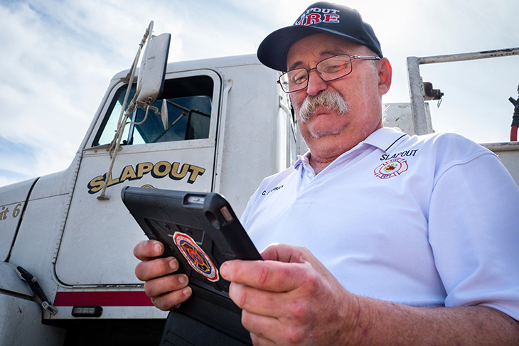
Slapout, Oklahoma, Fire Chief Charlie Starbuck is quick to say practically everything in his state revolves around weather, one of many reasons he gives when talking about the importance and value of the Oklahoma Mesonet.
The Oklahoma Mesonet, a world-class network of environmental monitoring stations, is celebrating its 25th anniversary in 2019. A system of 120 stations with at least one in every county, the network was designed and implemented by cooperating scientists at Oklahoma State University and the University of Oklahoma, with the two universities continuing to provide valuable subject-matter expertise to this day.
“We originally started using the Oklahoma Mesonet for storm spotting purposes, but wildland fire management has increasingly become a major focus in recent years, given the number and intensity of some of the wildfires we have experienced,” Starbuck said. “The Oklahoma Mesonet has a section called OK-FIRE, which has proven to be invaluable. I can get all the information I need on one page, be it on my computer, tablet or phone.”
OK-FIRE provides a comprehensive set of products for fire weather, fire danger and smoke dispersion that incorporates an 84-hour forecast, the OK-FIRE wildland fire management website, and regional training and support for users. Applications include wildfire, prescribed burning and smoke management.
“Mother Nature is unpredictable, so having access to the information being provided by stations in multiple counties lets me see what is happening elsewhere in real time, and use that to know what is heading our way,” Starbuck said.
Such as the morning of March 6, 2017. Starbuck’s pager went off at 10:53 a.m. and informed him that a grass fire was burning in a Beaver County oil field. He led the trek to the fire with eight of his crew and three fire trucks. He saw the fire had already expanded in size, fueled by low humidity, tinder-dry grass and winds gusting in excess of 50 miles per hour, all present as OK-FIRE data. Starbuck was on the phone immediately, calling for the aid of other area fire departments.
The blaze was part of a wildfire outbreak that burned 781,000 acres in Oklahoma, and another 608,000 acres in Kansas as well as wide stretches of land in the Texas Panhandle. The outbreak officially would be dubbed “the Northwest Complex Fire,” but many Oklahomans still refer to it by the name initially used by Mark Goeller, director of Oklahoma Forestry Services.
As the wildfire progressed, Goeller needed a name for it and used Starbuck’s. Charlie’s sister in Virginia even called him to ask about the “Starbuck fire” she had seen on the national news. His sudden fame may have caught the Slapout fire chief by surprise, but he had no such problems in seeing the challenges he and his firefighters were combatting, thanks to updated OK-FIRE data made available every five to 10 minutes through the Oklahoma Mesonet system.
Fast and Accurate
“It’s amazing how valuable having needed information available and updated every five minutes can be,” said Albert Ashwood, now retired, but who served as director of the Oklahoma Department of Emergency Management for 21 years.
Ashwood should know. Oklahoma ranks third nationally – behind only Texas and California – in the number of disaster declarations since the federal government began keeping records of such occurrences.
“Our weather is very erratic and Oklahoma experiences a lot of hazards, so we need to be as precise as possible to effectively respond to emergency situations,” he said. “The value of being able to use the Oklahoma Mesonet to look at any county in the state and determine local conditions can’t be stressed enough.”
It is about more than just determining what is going to happen in Beaver County, naturally, even for the Slapout Fire Department, a unit regularly called upon to take part in “task force” operations that take it away from home.
“We are sometimes called upon to provide fire department services in other parts of the state,” Starbuck said. “I am able to determine what we are heading into just by looking at OK-FIRE, which is critical. I can call my fellow fire chiefs and we can get our game face on, talk about what is needed and how we can best work together.”
Since 2006, more than 1,600 wildland fire managers have been trained through the OK-FIRE program.
Wildfires can and have devastated countless lives, reminds Derrell McBee, OSU Cooperative Extension agricultural educator and Harper County Extension Office director, who was at the center of recovery efforts from the historic March 2017 wildfire outbreak.
“When one of your clients, who is also a good friend, calls and is basically in tears on the phone and he has lost most of his 3,000 acres of grass pasture and hay, and you ask how he is doing, and his response is, oh, I’m okay; he is not okay,” McBee said.
Making matters worse, the March 2017 wildfires were the third in a series of hardships wrought by Mother Nature in and around Harper County. The area suffered wildfire damage in November of 2016. Next there was a massive ice storm that left some rural families without power for 18 days. Then came the March 7 wildfires.
“Believe it when people talk about the importance of the information provided through the Oklahoma Mesonet, and it goes beyond emergencies and disasters,” McBee said. “Truthfully, getting on the Mesonet is not a bad way to start your day, whether you’re a wildland fire manager, agricultural producer, community event planner or are just going to be outside.”
The Oklahoma Mesonet is available for use by the public. Find it online at mesonet.org or by visiting the App Store at Google Play or iTunes. The Oklahoma Mesonet is funded by the State of Oklahoma, partnerships with federal agencies, private-sector user fees, and grants and contracts.
