From satellites to grasslands: Geography professor Gholizadeh awarded NASA grant
Thursday, September 22, 2022
Media Contact: Elizabeth Gosney | CAS Marketing and Communications Manager | 405-744-7497 | egosney@okstate.edu
Oklahoma State University Department of Geography assistant professor Dr. Hamed Gholizadeh was awarded the NASA New (Early Career) Investigator Program in Earth Science award in 2021, a recognition that includes nearly $400 thousand to fund his research into how remote sensing technologies can be used to monitor grassland biodiversity.
“NASA solicits proposals to this program every three years, which makes this program highly competitive,” said Gholizadeh, who completed his Ph.D. in geography in 2016 and postdoctoral work in 2019. “I am thrilled to receive this award.”
Gholizadeh’s research involves collecting hyperspectral images of the earth’s surface — specifically tall grass prairies — using aircraft- and satellite-mounted cameras. A good portion of the NASA funding has gone to hiring pilots, specialists and airplanes to collect these images, which capture information beyond what the human eye can see.

“While cameras on our cellphones capture RGB images, or images in three layers — red, green, blue — the cameras we use in our research collect electromagnetic radiation in approximately 300 layers,” Gholizadeh said. “These cameras are capable of capturing near-infrared and shortwave infra-red. Collecting this kind of data requires high-tech, cutting-edge sensors.”
One of these cameras is mounted on the International Space Station and is operated by the German Aerospace Center (DLR). Through a collaboration with NASA, DLR collects images of specific grassland areas from space and then sends them to Gholizadeh for analysis.
Gholizadeh’s hope is that remote sensing will provide a way to track biodiversity changes over time, as the alternative is sending botanists to grasslands to document the species they see, he said.
“But that would take a lot of time, and even if they finished, it would be just one point in time,” Gholizadeh said. “A recent study showed that since the 1970s, the population size of many species has declined by about 70 percent. Just imagine if we can develop models to monitor biodiversity using remote sensing — we can look at biodiversity changes over time and track trends relatively fast and relatively cheaply compared to other, traditional ways.”
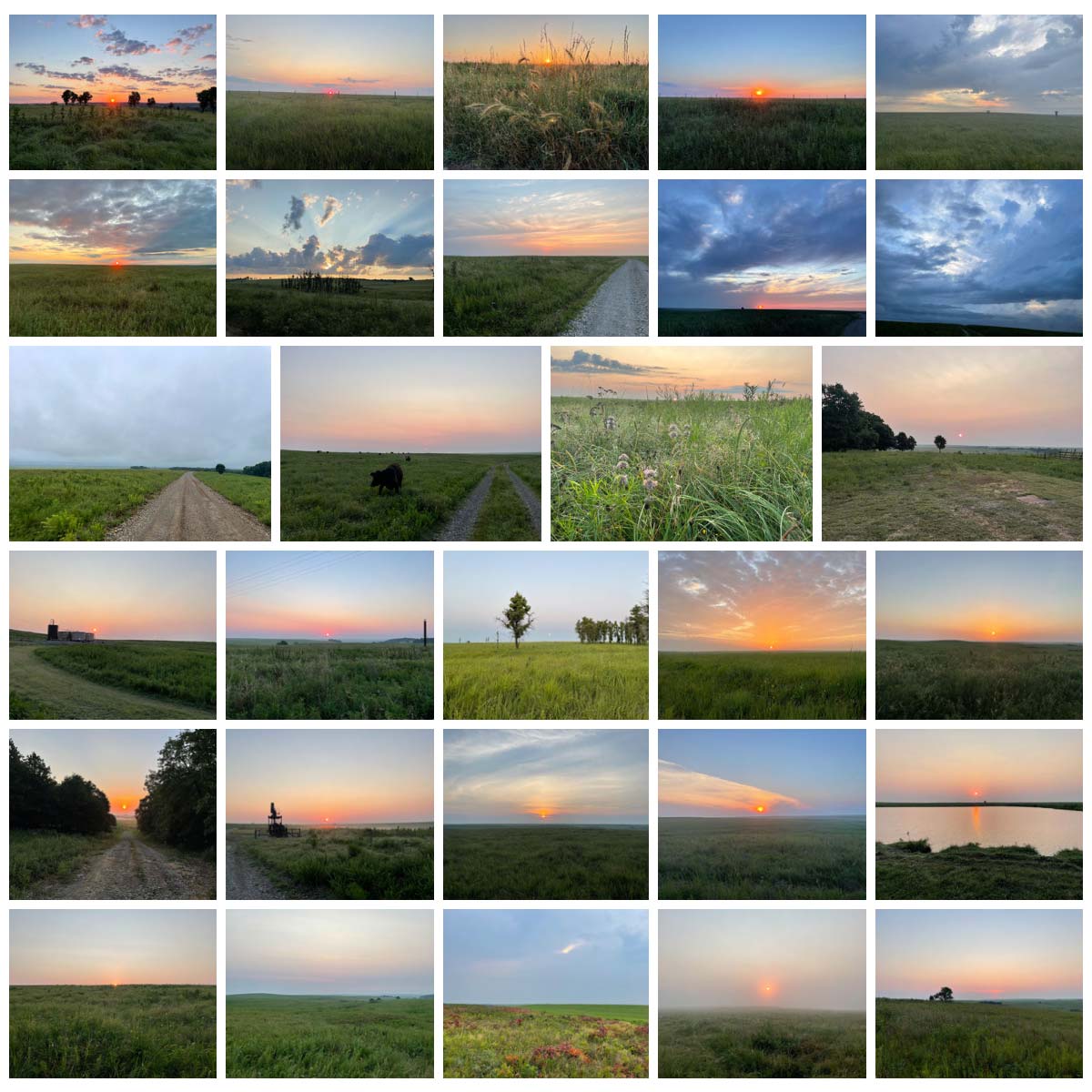
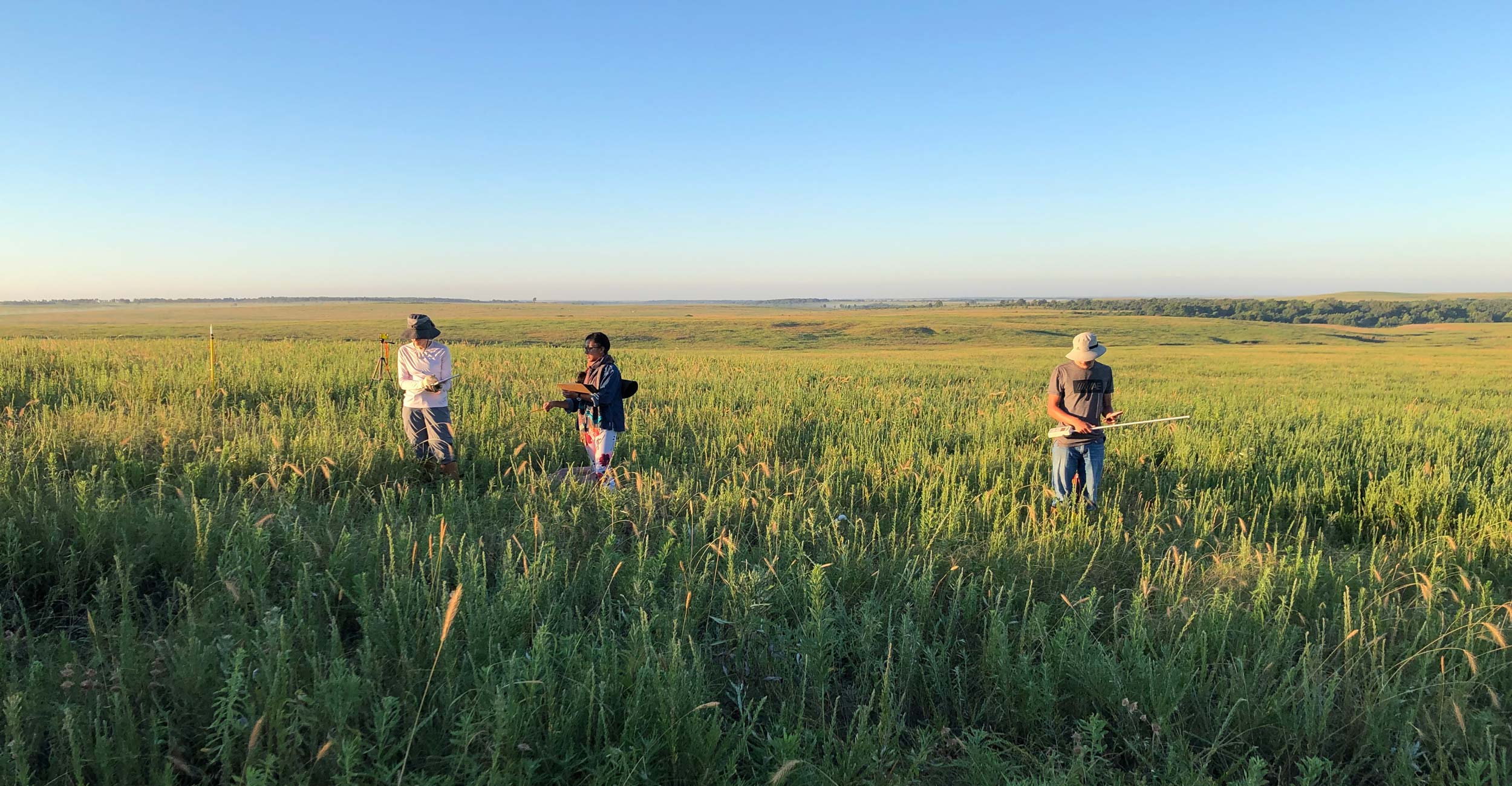
It’s estimated that 25 to 40% of the earth’s land surface is covered in grassland, so Gholizadeh has by necessity focused his research on a relatively small area in Joseph H. Williams Tallgrass Prairie Preserve’s 39,650 acres near Pawhuska, Oklahoma. In addition to collecting remote sensing images of the area, Gholizadeh and his team of botanists and OSU undergraduate and graduate students completed two field camps — one in 2021 and another in 2022 — to gather physical samples and species composition data.
“We use field campaign data to see how reliable our remote sensing models are,” Gholizadeh said.
He added that they placed a 1x1-meter frame at 2,500 different points across the preserve as part of their “ground truth” or “ground reference” data collection.
Gholizadeh also enlisted the help of Dr. Benedicte Bachelot, an assistant professor in the OSU Department of Plant Biology, Ecology, and Evolution, who is the project’s plant community ecologist investigating plant-fungi relationships.
“Nature is complex. If you want to understand it, you will need tools and skills from many disciplines,” Bachelot said. “You might try to become a jack of all trades, but ultimately you can’t know or do it all. You need to develop cross-disciplinary collaboration if you want your research to expand beyond your small expertise. In this specific case, collaborating with Dr. Gholizadeh allows me to explore what airborne data can or cannot tell us.”
Having collected the necessary data from remote sensing images and on-the-ground field camps, Gholizadeh and his team are entering the data analysis stage of the research.
“Now we’ll focus on developing models and algorithms to see with what level of certainty we can capture plant diversity using remote sensing technology,” Gholizadeh said. “In doing so, we can broaden our understanding of the response of grassland ecosystems to various environmental changes and identify strategies to maintain and enhance their biodiversity.”